Volcanoes, earthquakes, tsunamis: The ‘Ring of Fire’ explained
The Pacific’s “Ring of Fire” is a breeding ground for natural disasters. Here’s a look at the most recent incidents.
A magnitude 6.6 earthquake struck the Pacific island nation of Papua New Guinea on Monday, the U.S. Geological Survey said.
The quake struck about 80 miles east of Kimbre on the island of New Britain at a depth of about 25 miles, according to the agency.
No tsunami watches or warnings were issued due to the quake, and there were no immediate reports of injuries.
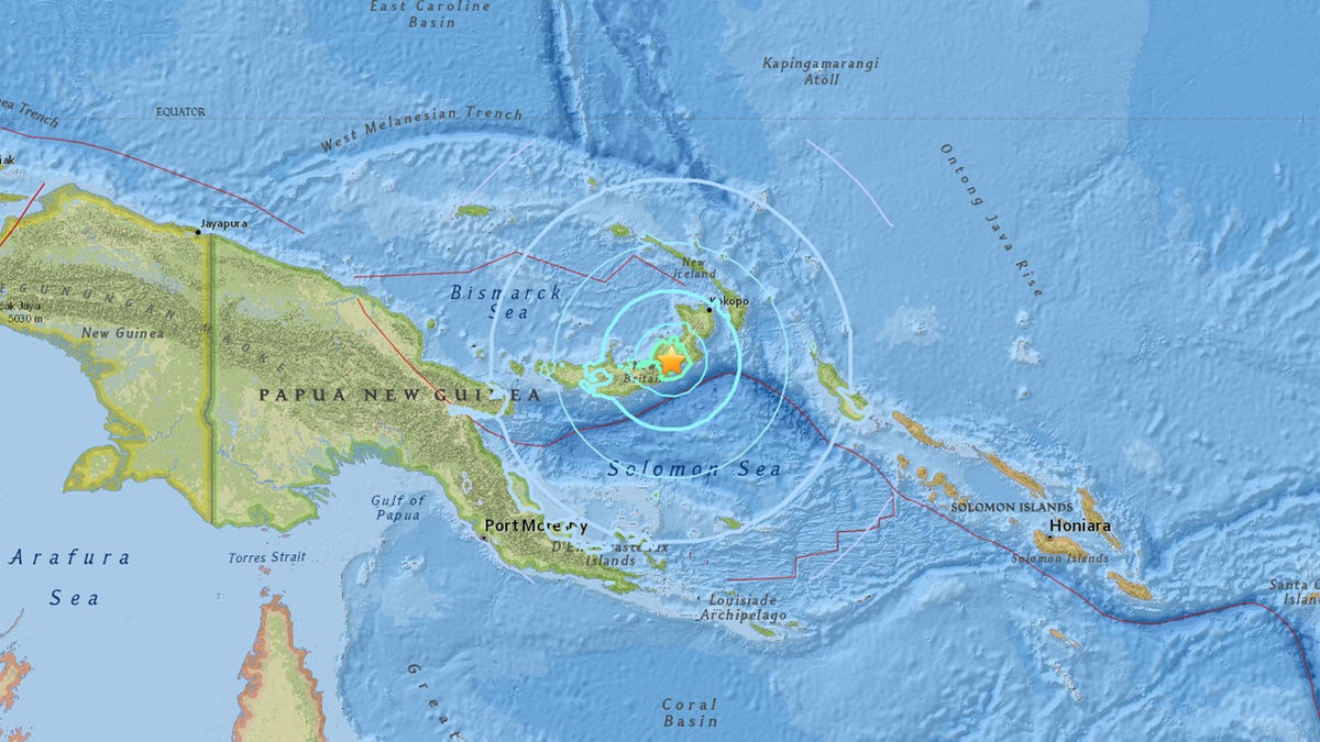
The location of a 6.6 magnitude earthquake in Papua New Guinea on Monday. (USGS)
A magnitude 7.5 quake last month in central Papua New Guinea region killed at least 125 people and forced another 35,000 from their homes.
The region is remote and undeveloped, and assessments about the scale of the damage and injuries have been slow to filter out. Strong aftershocks have continued to rattle the area.
The quake on Monday was just the latest spark of activity this year along the volatile "Ring of Fire" seismic fault system.
'RING OF FIRE' FURY STRIKES ALASKA, PHILIPPINES, JAPAN
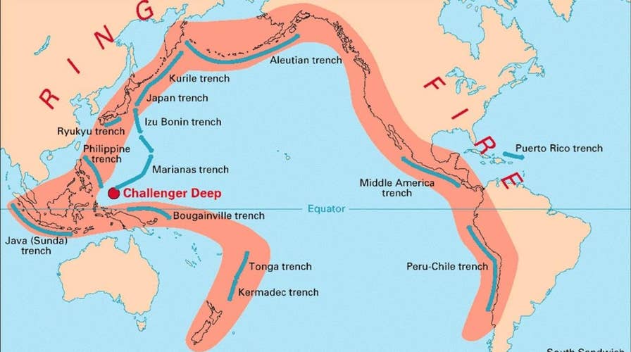
More than half the world's active volcanoes located above ground are in this ring, according to the USGS.
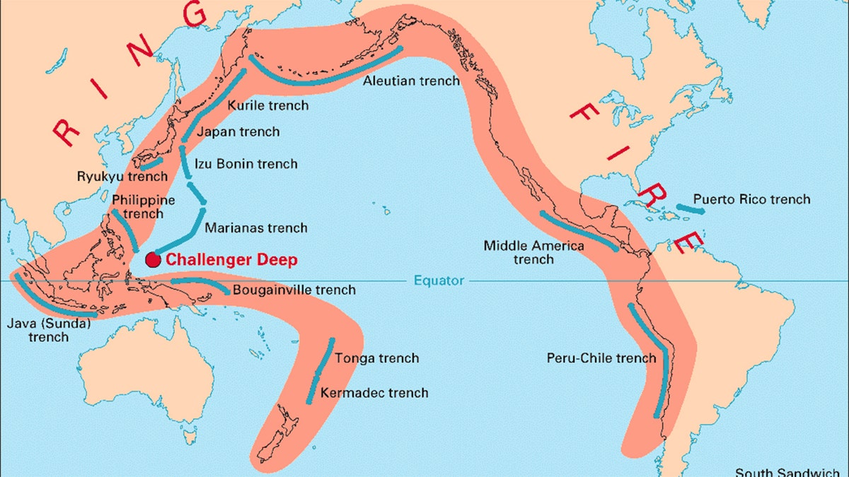
A map showing the "Ring of Fire," where more than half of the world's active volcanoes above sea level encircle the Pacific Ocean. (USGS)
The region is the location of most of Earth's subduction zones, where oceanic plates slide under the lighter continental plates. Earthquakes tend to happen when those plates scrape or subside underneath each other, and, when that happens at sea, it can trigger tsunamis.
So far this year, activity in the volatile region included volcanic eruptions in Japan and the Phillipines, and an earthquake off the coast of Alaska.
The Associated Press contributed to this report.

Fox News' "Antisemitism Exposed" newsletter brings you stories on the rising anti-Jewish prejudice across the U.S. and the world.